

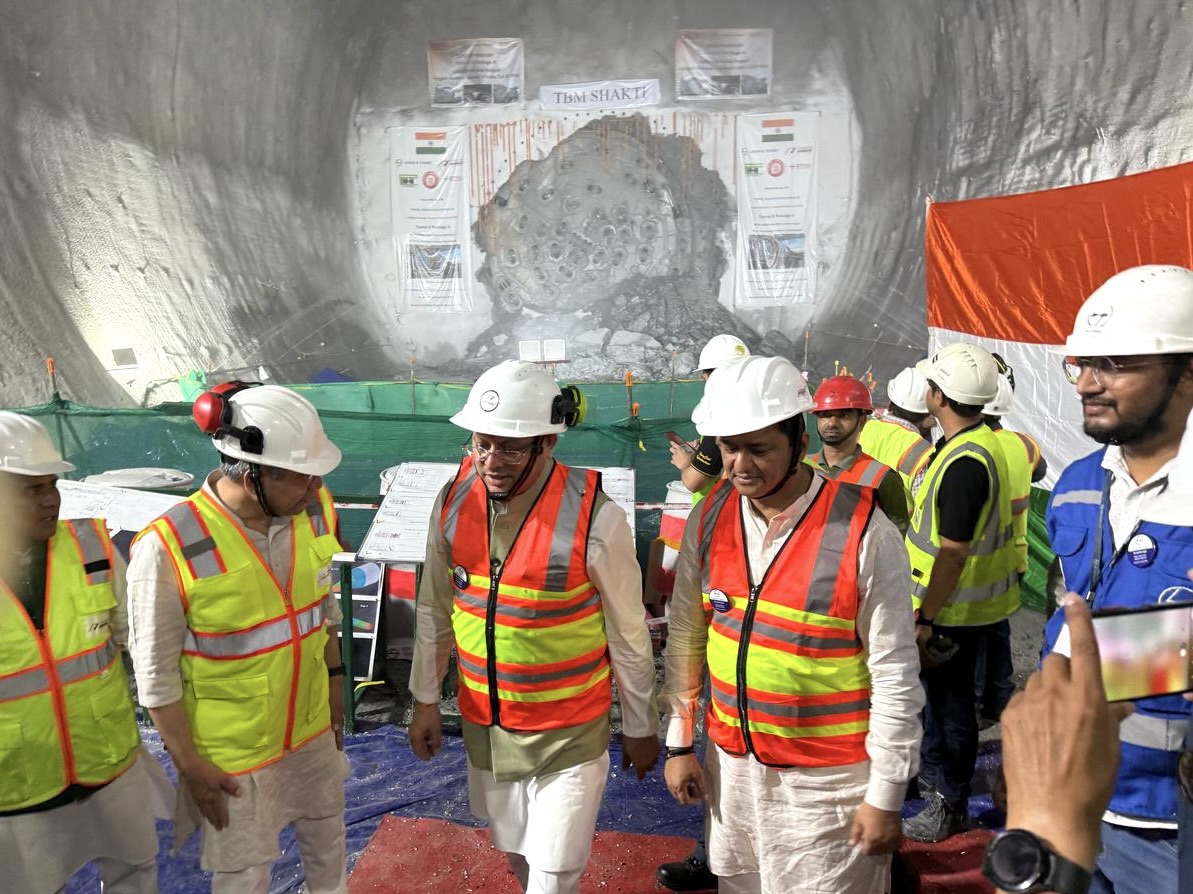
Bharat’s longest transport Tunnel no. 8 of Rishikesh-Karnaprayag project
Today’s Bharat’s longest transport tunnel Tunnel no. 8 of Rishikesh-Karnaprayag project tunnel braking ceromany witnessed by Ashwini Vaishnav, Minister for Railways, IT & Meity, CM Uttarakhand and Local MP Anil Balono. Tunnel No. 8 having length 14.58 km in Rishikesh- Karanprayag Railway Project is going to be the longest transport tunnel in India.
Presently Rail Tunnel – 12.75 Km between Khari and Sumber Stations on Katra-Banihal Section of Udhampur Srinagar Baramulla Rail Link (#USBRL) Road Tunnel – 9.02 Km – Atal tunnel regarded as longest road tunnel in Manali-Leh Highway.
Rishikesh-Karnaprayag new BG rail link project
Alignment has 12 new stations, 16 main tunnels and 5 important /19 major bridges covering 5 districts (Dehradun, Tehri Garhwal, Pauri Garhwal, Rudraprayag and Chamoli) of the state of Uttarakhand.
The objective of providing Rail link between Rishikesh and Karnaprayag is to Facilitate easy access to pilgrimage centers of Uttarakhand, to connect new trade centers of UK and development of backward areas and to serve the population living in the area.
Rail lines will reduce travel time and cost and open up opportunities for industrial development, cottage industry in the area, boost the economy and tourism prospects in the state.
Will connect important towns Devprayag, Srinagar, Rudraprayag, Gauchar and Karnaprayag.
Final Location Survey (FLS)
- Considering the topographical constraints and challenges, FLS made use of the latest technology and took the benefit of the expertise of international consultants, institutes of repute and eminent experts in the fields of tunnelling, bridges, railway etc. at the planning stage itself.
- Work of proof of consultancy was given to IIT-Roorkee, with Director, IIT Roorkee heading the team.
- To overcome constraints of accessibility imposed by rugged topography for the FLS work, State of the Art surveying technique Satellite imagery was used.
Highest resolution stereo satellite imagery available in the world for civilian use with 50 cm resolution captured by US World View-2 (WV-2) Satellite were used to develop a high accuracy (≈2m) Digital Elevation Model (DEM)
This was much superior to Google Earth, in a corridor of 2.5km either side of alignment finalized in the RECT Survey.
- The construction of railway lines in rugged Himalayan topography with complex geology have many risks/uncertainties and technical challenges.
- A Committee of Experts (EC) of international repute in the field of railway line construction in hilly areas were engaged. Composed of three eminent Experts – M Ravindra, (Ex-Chairman Railway Board) Railway expert, Dr. J Golshar of M/s Geoconsult Austria, International tunnel expert, Dr. V K Raina, International bridge expert.
Salient features
- 12 stations, 19 major bridges, 38 minor bridges
- Total length of project : 125.20
- 83% of this is tunnel (104 km)
- 14.72 % is open cutting embankments (18.4 km)
- 2.21 % is important bridges (3.07 Km)
- Total length of main tunnel 104 km and no of tunnel is 16
- Total tunnel length of the project is 213.57 km (16 Main tunnel of 104 km, 12 escape tunnel of 97.72km and 7.05km cross passage)
- Longest Tunnel: 14.58 km
- Bridge length: half a Km Srinagar Bridge no. 9
- Bridge height: 46.9 m Gauchar Bridge 15
- Longest span bridge: 125 m Devparyag bridge no. 6
Current Status of The Project
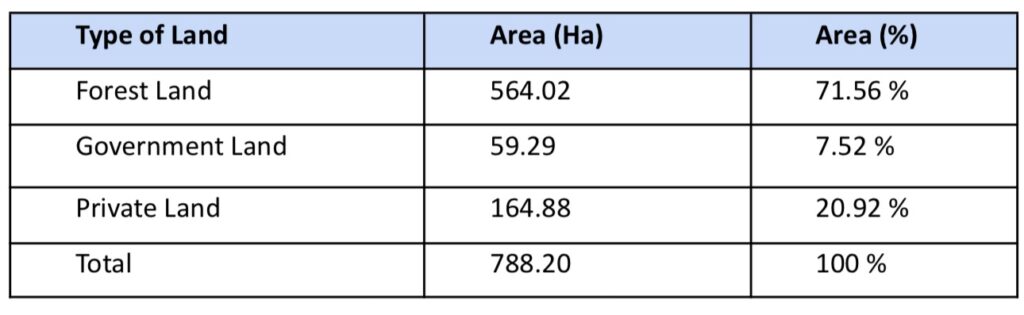
- Land: 100 % land was acquired before commencement of work. The details of forest, government and private land is as under:
- Enabling works carried out for fast tracking of works:
- Geological survey (1:5000 scale) and Geo-physical studies (Seismic and resistivity survey) for the entire project completed.
- Geo-Technical Investigations (GTI) for the entire project completed – 164 bore holes and 15.6 km of rock drilling (upto 600m deep).
- Hydrological studies (National Institute of Hydrology) and site-specific Seismic studies & MASW studies (IIT Roorkee) for all major bridges completed.
- Approach Road construction to various work sites completed.
- Adits tunnels completed for main tunnel works.
1st Block Section
- The 1st Block section of 5.7 km between existing Virbhadra station and Yog Nagari Rishikesh Station (PK-1A) was commissioned in March 2020.
- Train maintenance facilities have been developed
Tunnel
- Beyond km 6.00, the alignment is in tunnels. 16 tunnels have been divided in 10 packages. DD&PMC contracts completed the design work in all the packages.
- Tunnelling works of all tunnels started simultaneously.
- Present Tunnelling progress (including Main Tunnel, Escape Tunnel, Adits & Cross passage) is 195 km against a total scope of 213 km.
- Eight Adits in various tunnels were identified for creating additional work faces of tunnel excavation for facilitating early completion of long tunnels and were completed before the start of Main Tunneling work.
Railway Bridges
- Total 19 major bridges, 5 important and 38 minor bridges. Important bridges are 1 over Ganga, 1 over Chandrabhaga and 3 over Alaknanda.
- 08 major Bridges completed out of 19 major bridges. Three important bridges completed, one on Chandrabhaga and two over Alaknanda.
- One ROB & One RUB over NH/SH at Rishikesh has been completed.
- 03 Major Road bridges for accessibility to work sites at Gauchar, Srinagar & Sivai are completed.
- Work on Balance Important & Major Bridges (11 Nos) is in an advanced state of progress.
Commissioning Targets
- Virbhadra – Yog Nagari Rishikesh section commissioned on 20.03.2020.
- The tunneling works in the project are targeted to be completed by December’ 2025.
- Track works, electrical, OHE and S&T works have been planned and will commence soon.
Tunneling and T-08 tunnel
- IR has total tunnel length till 2014 was 125 km and since 2014 tunneling done is 468.08 km ie 3.7 times
- This is first successful TBM use in tunneling in Himalayan geological terrain and first in IR
- TBM single shield 9.11 meter excavation dia has tunneled 10.4 km NATM has tunneled 4.11 km.
- First 600 mt from portal o1 was done by NATM to launch TBM . From portal 2 Janasu end NATM worked continuously.
Geological Setting
- Formation: The tunnel predominantly traverses the Chandpur Formation of the Jaunsar Group.
- Rock Type: The principal rock unit is Chandpur Phyllite, which includes:
- Quarzitic and Schistose Phyllite with Intercalations of Quartzite Rocks
- Presence of Quartz Veins
Rock Mass Characteristics
- Structure: Closely to very closely jointed and Foliated
- Weathering & Strength: Slightly to moderately weathered and Moderately weak to moderately strong rock mass
- Geological Variability: High variability in rock mass conditions along the tunnel alignment.
Investigation Constraints:
- Access Difficulty: Challenging access due to rugged Himalayan terrain, leading to limited geological data.
- Geological Investigations: Initial Boreholes: 7 nos., total length 1196 m. Additional Boreholes: 2 nos., total length 1077 m
- Overburden: Maximum Overburden: 800 m (Approx 1 KM), Minimum Overburden: 70 m
- Tunnel Behaviour: Squeezing, very high Squeezing behaviour anticipated, especially under average to high overburden conditions due to weak rock mass conditions and depth.
Key Challenges in TBM Tunnel Construction
Geological Complexity
- Presence of heterogeneous rock conditions—ranging from poor to medium and hard rock—poses significant challenges for excavation and support.
- Squeezing ground conditions in approximately 20% of the tunnel route, requiring uninterrupted TBM operation except at designated stops.
- Medium to high overburden and deep seated landslides could involve large deformations/movements.
TBM Operation & Constraints
- Need for non-stop TBM progress along with ongoing geological and geophysical investigations during construction.
- Risk of TBM entrapment in squeezing zones.
- TBM must navigate through difficult terrain and varying ground conditions without unscheduled stoppages, demanding high system reliability and responsive support.
Water Ingress
- Significant water inflow identified in two major zones, with a maximum inflow rate of 2000 lpm, posing risks to equipment, safety, and progress rates. Probable water in Nallas locations.
Other Challenges
Logistics & Transportation
- Continuous transport of materials and segments along a 30 km national highway, complicated by Monsoon season impacts (e.g., landslides, road closures) and Yatra (pilgrimage) season traffic congestion.
- Material and segment delivery must remain uninterrupted, placing pressure on logistics and supply chain reliability.
Backfill Grouting System
- Grout pipeline system spans over 11 km, requiring frequent cleaning and maintenance;
- Adaptation to different mix designs across tunnel segments due to varied geological and structural conditions
Parallel Construction Activities
- Simultaneous execution of multiple construction activities: Cross passages, Tunnel excavation and TBM operation logistic.